GLUES
Global Assessment of Land Use dynamics on Greenhouse Gas Emissions and Ecosystem Services (GLUES)
GLUES is a consortium of project partners for the scientific coordination and synthesis of the BMBF "Sustainable Land Use Management" program.
The "Sustainable Land Management" program supports regional research projects. These projects work in different regions world-wide while being connected through international research programs.
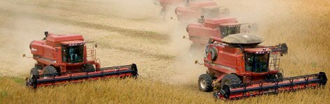
The GLUES project aims to support the international cross-disciplinary collaboration of research projects dealing with the issue of land use, greenhouse gas emissions and ecosystem services. This support is achieved through the development of standard scenarios and data sets for land use, climate change and socio-economic changes on various spatial and temporal scales and subsequent communication, coordination and integration of the results. The joint research is based on a common Geodata Infrastructure (GDI), which will be developed in the course of the project.
In technical terms, the GDI provides access to model and scenario results. This supports the cooperation between the regional projects and the GLUES consortium. At the same time, it enables the analysis and synthesis of global and regional impacts of land use management on ecosystem services and greenhouse gas emissions.
Another responsibility of the GLUES project is the development of concepts for the synthesis of results from regional research projects. The synthesis integrates the results of regional research projects, taking into account the requirements of different users and stakeholder groups. Through continuous communication and the development of interfaces to political processes, the results are made available to potential user groups and transferred into international political processes. The main outcomes are expected in terms of a coherent up-scaling, an interregional comparison of global ecosystem service assessments and the analysis of side-effects of land use decisions in different regions.
Thus, GLUES will improve the visibility of German land-use research in the international research community.
Project Partner
The GLUES consortium consists of the following project partners:
- UFZ (Coordinator) Helmholtz Centre for Environmental Research (Computational Landscape Ecology, Conservation Biology, Economics)
- KEI an Initiative of the Helmholtz Centre for Ocean Research Kiel (GEOMAR) and the Kiel Institute for the World Economy (IfW)
- PIK Potsdam Institute for Climate Impact Research
- TUD Professorship of Geoinformation Systems, Technische Universität Dresden
- UBO Institute of Food and Resource Economics, Chair of Economic and Agricultural Policy, Universität Bonn
- LMU Ludwig-Maximilians University Munich
- con terra Gesellschaft für Angewandte Informationstechnologie GmbH
- 52N Initiative for Geospatial Open Source Software mbH
Subcontract partners are:
- Peter Moll & Ute Zander, Consulting Science for Sustainable Development
- IBN Institute for Biodiversity - Network
- METRONOM Agentur für Kommunikation und Design
The KEI manly contributes to the following work packages which it additionally coordinates:
- WP2 “Methodical Cohesion”
- WP3 “Medium-Term Projections”
Work Package 2 “Methodical Cohesion”
Within work package 2 “Methodical Cohesion”, global data is collected that contains the whole range of information from the entire natural environment prerequisites to economic and institutional facts.
In order to harmonize the collected information, a consistent metadata scheme is developed. In addition, a Geodata Infrastructure (GDI) is established to serve as a platform for data exchange of metadata and model results. As a result, these data sets are provided to the regional projects by the GDI and can be used in their models as external and harmonized information.
Work Package 3 “Medium-Term Projections”
The work package 3 “Medium-Term Projections” aims to provide regional projects with common scenarios, which include combinations of global parameters and associated data that represent potential future development paths.
These global parameters include trends in decadal climate change and population growth, projections of agricultural markets as well as water availability and water efficiency in the agricultural sector. Their influence on land use will be linked to, for example, information on the effects of climate change on yield potentials or supply-side bioenergy policies and information on population, GDP and preference changes on the demand side. Thus, scenarios are defined by the combination of natural and socio-economic parameters, which serve as the basis for the integrated modelling approaches of the regional projects. Within this work package, the task of KEI is the mapping of the decadal climate change (GEOMAR) and the modelling of global land use changes (IfW).
Project Coordination
Project Coordinator: Ruth Delzeit ruth.delzeit@ifw-kiel.de